You have no items in your shopping cart.
How to access Relief Shading with Garmin BlueChart g3 Vision mapping
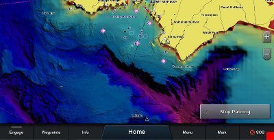
BlueChart g3 Vision now gives even more mapping information than before, thanks to a recent update with the addition of high-resolution relief shading.
Relief Shading brings bottom detail to life. For the waters around Australia and New Zealand, the easy-to-interpret colour palette reveals complex and intricate bottom detail of channels, offshore shelves, artificial reefs, wrecks and sandbars, so you can understand your surroundings at a glance and easily identify fish-holding structure.
The Relief Shading feature can be downloaded to Bluechart g3 Vision cards via the ActiveCaptain app.
Here are some easy steps to access Relief Shading:
1. Register your >Chart Card using Garmin Express (download here). Make sure you use the same email address that you use for the Active Captain app.
2. Download the Garmin Active Captain app from App Store.
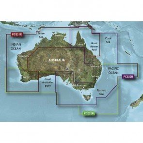
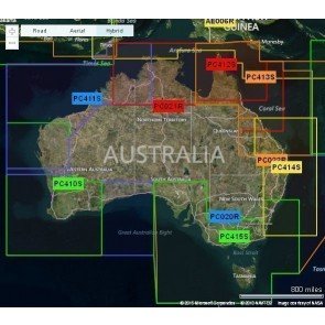
Note: Relief Shading is available with G3 Vision charts only - not available with Blue Chart
3. Login to Active Captain (using the same email address as previously used at Step 1)
4. Go to Chart, Select the Menu, Download Charts. You should now see your registered Garmin G3 Vision Chart.
5. You can now begin to download the small mapping tiles after reviewing the next point.
6. You will require large amounts of Hard Drive space, so if your mobile is a 16 GB or 32 GB model, you will be very restricted to how many tiles you can download! The best mobile phones to use are the 128 GB and the 256 GB if you want to download multiple G3 Vision Charts.
7. Go to your compatible chartplotter and from the Home page select Settings.
8. Then select Communications, followed by Wireless Devices.
9. Insert your SD Card into your Garmin >Head unit, remembering you will require a large amount of free space for the downloaded information (maximum allowed SD Card size is 32 GB).
10. Then select WIFI Network, turn on WIFI. The Wireless name of your product will appear – so you are now able to connect to your mobile phone and begin to transfer the information over to your Garmin >Head unit.
11. Monitor the Active Captain App on your phone and Garmin device to see the progress of the transfer. Done!
For tips and other advice on all things fishfinders and sounders, give us a call at CH Smith Marine on (03) 9403 4800.
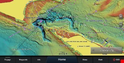
Bottom detail off Point Lonsdale.
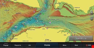
Bottom detail off Phillip Island, Victoria.
Bottom detail off Barrett Reef, Wellington NZ.