Paperback 144pgs
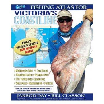
Fishing Atlas for Victoria's Coastline
Find it In: Fishing Tackle, Boat & Fishing Books.,
Status: On order with supplier, awaiting delivery
Fishing Atlas for Victoria's Coastline offers a complete guide to fishing Victoria's bays, inlets, offshore and estuarine waters, including GPS marks to get you amongst the Fish.
This edition features updated fishing maps and information from Jarrod Day and Bill Classon to give you the best and most comprehensive details on fishing Victoria's saltwater. Where and when to Fish and how to catch various Species is covered with detailed maps, identifying specific fishing areas from Mallacoota in the east to Portland in the west and everywhere in-between.
Information has been sourced from the most knowledgeable anglers from across the State to ensure the most detailed and complete guide has been put together. Available Species, best baits, best methods, times of year, Boat ramps, bait gathering areas, potential dangers and myriad of other important information is presented in an easy-to-read format.
Precise colour maps show all of the areas discussed in the text as well as points of interest to anglers, including marine parks and sanctuaries.
Features:
- Paperback 144pgs
- Detailed maps
- What to Fish for
- Where to catch fish
- When best to target particular species
- Boat ramps
- Landbased and Boat based fishing
- GPS marks
- Tackle shop outlets
Chapters include:
- Mallacoota
- Far East Gippsland (Cape Howe to Tamboon Inlet)
- East Gippsland (Sydenham Inlet to Lake Tyers)
- Gippsland Lakes (Lakes Entrance to Seaspray)
- Ninety Mile Beach
- South Gippsland (inc. Wilsons Promontory)
- Western Port
- Port Phillip Bay
- Near Western Coast (inc. Barwon River and Heads)
- Mid West Coast (inc. Aireys Inlet to Apollo Bay)
- Far West Coast (Cape Otway to Warrnambool)
| MPN | B2921-1465 |
|---|---|
| UPC | 971865132921 |
| Brand | Generic |
| Unit | EACH |


