You have no items in your shopping cart.
This product has been discontinued.
150mmW x 155mmH x 61mmD
Weight - 0.8kg
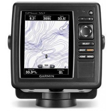
Garmin GPSMAP557 Chartplotter
SKU: Garmin-GPSMAP557-Chartplotter
Brand: Find it In: Marine GPS, Marine Chart Plotters.
Status: Discontinued
Product Description
Details
Garmin GPSMAP557 chartplotter will be the focus of your Helm with easy visibility, day or night, and a user friendly interface. 10Hz Receiver included will give a super fast refresh for fluid display of vessel movement and position so you never lose track of your precise location.
- Australia & New Zealand Bluechart g2 Cartography included
- 5" >VGA 480 x 640 touchscreen Display
- 100 Routes and 5000 Waypoints
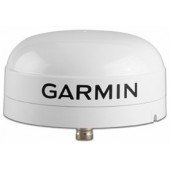
- Internal 10Hz GPS Antenna supports multiple satellite systems: GPS, GLONASS
- NMEA 2000 Interface with NMEA0183 compatibility
- Full wireless connectivity - connect to Garmin Blue Chart App & plan a trip on your iPad or iPhone and transfer the data across.
- Dual microSD card slots
- IPX7 Standard Waterproofing
- Includes GPSMAP 557 unit, Power/data cable, Tilt/swivel mount, Flush mount kit, Protective cover, Documentation
Options
Options
Specifications
Additional Information
| Brand | Garmin |
|---|---|
| Country of Manufacture | Taiwan |
| Physical Dimensions | 150mmW x 155mmH x 61mmD |
| Screen Size | 7.6cmW x 10.2 cmH |
| Display Resolution | 640W x 480V pixel |
| Screen Brightness | Unknown |
| IPX Water Rating | IPX7 |
| Voltage | 12vDC |
| Video Input Ports | None |
| Video Output Ports | None |
| Mounting Options | Bracket Mount and Flush-mount |
| WiFi Connectivity | Builtin |
| Radar Compatible | Yes |
| Waypoints | 5000 |
| Routes | 100 |
| Track Log | 50000 |
| Supports AIS (tracks target ships position) | Yes |
Reviews


