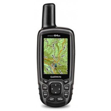
61mmW x 160mmH x 36mmD
Garmin GPSMAP64st Handheld GPS
Find it In: Land GPS, Outdoor Hand Held GPS.,
Status: Discontinued
Garmin GPSMAP64st Handheld GPS is a rugged, full-featured handheld GPS with GLONASS, built-in 3-axis electronic Compass and wireless connectivity - making it perfect for bushwalking and hiking.
Featuring a 2.6” sunlight-readable colour screen, and a high-sensitivity GPS and GLONASS Receiver with a quad helix Antenna for superior reception, the GPSMAP 64st locates your position quickly and precisely. It also comes preloaded TOPO Lite Australia and New Zealand maps, plus a 1-year BirdsEye Satellite Imagery subscription. Map detail includes national, state and local parks and forests, along with terrain contours, elevation information, trails, rivers, lakes and points of interest. You can also download Garmin Custom Maps, as well as marine mapping.
Its built-in 3-axis tilt-compensated electronic Compass shows your Heading even when you’re standing still, while its barometric altimeter tracks changes in pressure to pinpoint your precise altitude. You can even use it to Plot barometric pressure over time, which can help you keep an eye on changing weather conditions.
Features:
- Display: 2.6” sunlight-readable TFT 65K color screen, 160 x 240 pixels
- IPX7 waterproof protection
- High-sensitivity GPS and GLONASS Receiver with quad helix antenna
- 3-axis Compass with barometric altimeter
- Special paperless >Geocaching Navigation mode
- Preloaded >TOPO Lite Australia and New Zealand maps
- 1-year BirdsEye Satellite Imagery subscription
- 5000 waypoints, with 200 routes
- Tracklog of 10,000 points, 200 saved tracks
- NMEA 0183 compatible
- Wireless connectivity via Bluetooth technology¹ or ANT+
- Smart Notifications - receive email, texts and alerts wirelessly from your compatible smartphone
- Battery Life: 2 AA's (not included), 16 hours typical
| MPN | 010-01199-24 |
|---|---|
| UPC | 753759115890 |
| Replacement Product (SKU) | GPA0685 |
| Brand | Garmin |


