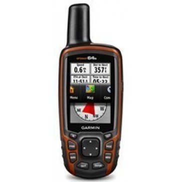
61mmW x 160mmH x 36mmD
Garmin GPSMAP64s
Find it In: Land GPS, Outdoor Hand Held GPS.,
Status: Discontinued
Garmin GPSMAP64s is a GPS Receiver that tracks up to 12 GPS satellites at a time, giving a position Fix in as little as 15 seconds. Thanks to new SiRFIII architecture, it stays locked onto the satellites in the toughest of conditions - even under heavy foliage or in deep canyons.
GPSMAP64s maintains the strengths of the GPSMAP62 series, including quad helix antenna, great display and tough housing, while adding desirable features such as GLONASS for optimised positioning, a dual battery system, expanded internal memory and wireless connectivity to enable enhanced communication using new features such as Live Track and Smart Notifications.
GPSMAP64s has a built-in 3-axis tilt-compensated electronic Compass, which shows your Heading even when you’re standing still, without holding it level. Its barometric altimeter tracks changes in pressure to pinpoint your precise altitude, and you can even use it to Plot barometric pressure over time, which can help you keep an eye on changing weather conditions.
Share your waypoints, tracks, routes and geocaches wirelessly with other compatible devices. Your friends can enjoy your favourite Hike or cache without waiting for you to plug in to your computer — simply press “send” to transfer your information to another Garmin handheld. With Smart Notification you can wirelessly receive email, texts and alerts from your compatible iPhone 4s or later. Stay connected without having to dig into your backpack for your smartphone.
Features:
- Large 256 colour outstanding daylight viewable TFT screen - 36mm x 55mm and 160 x 240 Pixels.
- Special paperless >Geocaching Navigation Mode.
- Trip Computer: Current speed, average speed, resetable maximum speed, trip timer and distance.
- 4gb Internal Memory, microSD card Slot.
- 2000 Waypoints with name and graphic symbol, 10 nearest (automatic) and 10 proximity.
- 200 reversible routes of upto 250 waypoints.
- Tracklog Points: 10,000.
- Area calculation feature calculates the size of an area that has been circumnavigated. Ideal for measuring areas of fields, bodies of water etc.
- Best Hunting and fishing Times.
- Waterproof case to IPX7 standard.
- USB & NMEA0183 connectivity
- Major highway map of Australia.
- Custom Maps Compatible.
- City Navigator, >TOPO Australia or MapSource Bluechart Pacific map options.
- Battery Life: 2 AA's (not included) 16 hours typical.
- High-sensitivity GPS and GLONASS Receiver with quad helix antenna
- 1-year BirdsEye Satellite Imagery subscription
- 3-axis Compass with barometric altimeter
- Wireless connectivity via Bluetooth technology or ANT+
- Barometric Alimeter for precise elevation reading and detailed elevation profiles
- Electronic 3-Axis Compass provides accurate direction even while standing still – compass works in any position
- Additional Mapping: Add more maps, such as detailed topographic, marine (BlueChart® g2), and road maps (City Navigator® NT). You can also download BirdsEye Select maps and Garmin Custom Maps directly on your handheld.
| MPN | 010-01199-10 |
|---|---|
| UPC | 753759115838 |
| Brand | Garmin |
| Country of Manufacture | Taiwan |


