Why should I update my Navionics card?
One of the benefits of having an Navionics map is peace of mind in knowing you'll have access to the most up-to-date charts and information whenever you are on the water.
These cards offer more content and great value because you get 12 months of Freshest Data (from date of registration), with more than 2,000 updates each day to Nautical Charts, points of interest, tides & currents, port plans, SonarCharts and Community Edits. These Community Edits are being constantly updated by users to ensure information is kept current.
To update your card, all you need to do is visit the Navionics website and download the update.
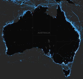
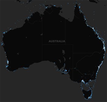
You can see just how often the charts are being updated at the Navionics website – with the Navionics Heat map, which provides a representation of the size and the scope of these updates worldwide.
The Heat map acts as an interactive display of the quantity and the position of each update brought to the map, with three time-period filters so you can see growth across the last two years.
Check out the images to the right, for example – with the amount of updates over the last 2 years at the top, and then updates in the last 6 months alone below!
Have a look for yourself at the Navionics website, and see the difference!
For more information on all the latest charts and fishfinders, get in touch with us at CH Smith Marine on (03) 9403 4800.
