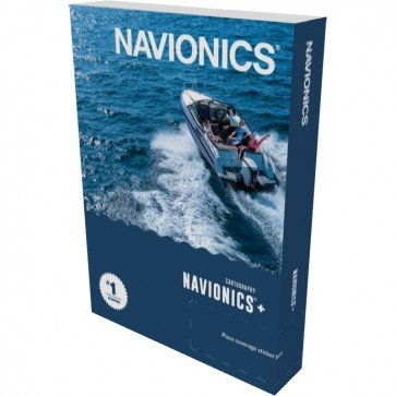
Navionics+ Charts Zoom

Navionics+ Charts
Bestseller

Navionics+ Charts

Brand:
Find it In: Marine GPS, Marine Mapping Software.
Unit: EACH
ImageGeneral DescriptionStatusPriceQty
Navionics+ Charts - Regular Coverage - 26R Australia, West Regular Coverage - 26R Australia, West
MPN: 010-C1359-30
Sku: GPB101
In Stock Hurry Limited Supply

RRP: $200.00

NOW: $187.00

Navionics+ Charts - Regular Coverage - 27R Australia, Northeast Regular Coverage - 27R Australia, Northeast
MPN: 010-C1360-30
Sku: GPB102
In Stock Hurry Limited Supply

RRP: $200.00

NOW: $187.00

Navionics+ Charts - Regular Coverage - 28R Australia, Southeast Regular Coverage - 28R Australia, Southeast
MPN: 010-C1361-30
Sku: GPB103
In Stock Hurry Limited Supply

RRP: $200.00

NOW: $187.00

Navionics+ Charts - Regular Coverage - 29R New Zealand Regular Coverage - 29R New Zealand
MPN: 010-C1362-30
Sku: GPB104
On order with supplier, awaiting delivery

RRP: $200.00

NOW: $187.00

Navionics+ Charts - Large Coverage - 15L Australia East & New Zealand Large Coverage - 15L Australia East & New Zealand
MPN: 010-C1464-30
Sku: GPB1044
In Stock

RRP: $380.00

NOW: $349.00

Navionics+ Charts - Large Coverage - 16L Australia West & Central Large Coverage - 16L Australia West & Central
MPN: 010-C1465-30
Sku: GPB1045
In Stock Hurry Limited Supply

RRP: $380.00

NOW: $349.00

Navionics+ Charts - Large Coverage - 14L Pacific Islands Large Coverage - 14L Pacific Islands
MPN: 010-C1358-30
Sku: GPB1061
In Stock Hurry Limited Supply

RRP: $380.00

NOW: $359.10

Navionics+ Charts - Large Coverage - 10L Indian Ocean & South China Sea Large Coverage - 10L Indian Ocean & South China Sea
MPN: 010-C1293-30
Sku: GPB1062
In Stock Hurry Limited Supply

RRP: $319.99

NOW: $271.00

Navionics+ Charts - Large Coverage - 11L China Sea & Japan Large Coverage - 11L China Sea & Japan
MPN: 010-C1294-30
Sku: GPB1063
On order with supplier, awaiting delivery

RRP: $319.99

NOW: $271.00

Product Description
Details

Navionics+ Charts lets you buy a single card wherever you are, and then download the most up to date charts for which ever regions you need, even allowing updates to download charts for anywhere in the world! Navionics+ Regions also offers smaller, more closely defined areas with more detail.

You can freely update your card within 12 months of purchase to add/ remove any charts available as many times as you wish. This ensures that you always have the most recent maps with the most precise information and will ensure your display doesn't become bogged down and slow trying to process too large a map as you will be able to only load the area you will need for that trip.

When downloading the Navionics+ charts, you also have the option for SonarCharts (bathymetric data) to be included as well, which have previously only been available with the Platinum+ charts. This data gives you high definition detail of seabed structure that can help in locating fishing areas. Click for a demonstration of SonarCharts Bathymetric data.


  • Familiar Paper Chart Appearance with Both fishing & Cruising detail!
  • Regular updates with Navionics Community Data (conditions apply)
  • Intelligent Clarity IC™ Provides A Clear And Uncluttered Display. Easy To Read At All Zoom Levels.
  • Superb Detail Navaids With XPlain, Tides & Currents, Shaded Contours, Spot Soundings.
  • Full Seamless Technology. No Clutter. No Holes. No Discontinuities.
  • Check the Navionics Compatibility guide for your chartplotter unit.
Upgrade Cards - No Card Exchange Required
Specifications
Additional Information
BrandNavionics
Country of ManufactureItaly
Reviews
Write Your Own Review

Only registered users can write reviews. Please, log in or register