Lord Howe Island
Product Description
Details
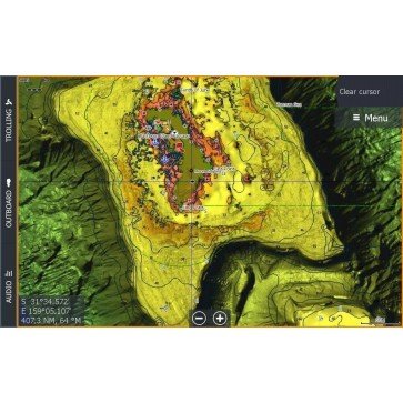
C-Map Reveal Marine Charts provide ultra-high Resolution Bathymetric imagery for Lowrance and Simrad Combos. View the sea floor in a new light and clearly identify sea floor structure, canyons and channels, along with reefs and ledges to find the best fishing and diving spots. C-Map Reveal explained.
- world-class >Vector Charts include all Navigation information, ranging from depth areas and contours, spot soundings, Navigation aids, moons, tides, currents, marine parks and more.
- C-Map Reveal charts help anglers and divers save time on the water, finding key areas faster with the high-definition views of structure, wrecks and contour changes on the sea floor.
- Data provided on Micro SD Card with Full SD Card adapter
Compatible with:
Specifications
Additional Information
| Brand | C-Map |
|---|---|
| Country of Manufacture | Italy |
Reviews


