You have no items in your shopping cart.
This product has been discontinued, and replaced with Garmin GPSMAP 7412xsv Combo


Garmin GPSMAP 7012 Chartplotter
SKU: Garmin-GPSMAP-7012-Chartplotter
Brand: Find it In: Fishing and Marine Electronics, Fish Finder-Plotter Combos.
Status: Discontinued


Product Description
Details
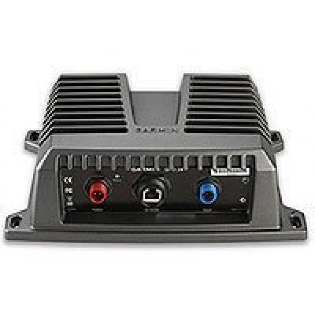
Garmin GPSMAP 7012 is a multifunction Touch Screen display that can act as a stand alone plotter or can add Fishfinder and >Radar options.
BLUECHART g2 Vision brings a new world of 3 dimensional perspective above or below the water, high Resolution satellite images and auto guidance.
- High speed processor for ultra fast screen redraw.
- BlueChart g2 Vision compatible.
- Screen display: Sunlight readable, 256-colour 12" diagonal 246mm x 185mm, colour >VGA 1024 x 768 Pixels.
- Tracks: 50,000 point automatic track log; 50 saved tracks (700 points each) lets you retrace your path in both directions.
- 5000 Waypoints with name and graphic symbol & proximity support.
- 100 reversible routes of up to 300 waypoints
- NMEA 2000 Interface
- Built-In tables for sun & moon calculations.
- Alarms: Anchor Drag, arrival, off-course, proximity, clock, shallow and deep water, battery.
- 12 Channel >WAAS capable GPS Receiver.
- Waterproof case to IPX7 standard.
- Video Input/output.
- Supplied with 7012, GPS17 GPS Antenna, Mount Bracket & Knobs, Sun Cover, Video Cable, NMEA0183 cable, NMEA2000 Drop Cable, 10m NMEA2000 Backbone cable, NMEA2000 power cable.
8 Pin Transducer Options
8 Pin Transducer Options

B60 600W Tilted Thru Hull Transducer - Garmin B60 600W Bronze T/H Transducer 20° Tilt
$455.00
Other Options
Other Options

Specifications
Additional Information
| Replacement Product (SKU) | ESI745 |
|---|---|
| Brand | Garmin |
| Country of Manufacture | Unknown |
| Physical Dimensions | 337mmW x 251mmH x 149mmD |
| Screen Size | 246mm x 185mm |
| Display Resolution | 1024W x 768V pixels |
| IPX Water Rating | IPX7 |
| Voltage | 12vDC |
| Video Input Ports | 2 RCA |
| Video Output Ports | 1 VGA |
| Mounting Options | Bracket Mount and Flush-mount |
| WiFi Connectivity | Builtin |
| Radar Compatible | Yes |
| Accepted Map Cards | Navionics Micro SD Silver |
| Waypoints | 5000 |
| Routes | 100 |
| Track Log | 300 |
| Sonar Compatible | Yes |
| Supports AIS (tracks target ships position) | Yes |
| Tide Tables (from map card option) | Yes |
Reviews


