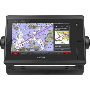
Garmin GPSMAP 7408xsv Combo
Find it In: Fishing and Marine Electronics, Fish Finder-Plotter Combos.,
Status: Discontinued
Garmin GPSMAP 7408xsv Combo Fishfinder chartplotter has a 8" pinch to zoom display that can act as a Chart Plotter and Fishfinder, with >Radar option.
The GPSMAP 7408xsv combo includes built-in dual CHIRP Sonar plus CHIRP DownVü and CHIRP SideVü scanning Sonar. Its internal 10 >Hz GPS updates your position and Heading 10 times per second. GPSMAP 7408xsv is fully network capable, including Garmin Network and NMEA 2000, and offers the conveniences of built-in Wi-Fi connectivity and built-in Advanced Sonar Capabilities, including 1 kW dual CHIRP Sonar.
Also supported are 50 kHz/200 kHz, 77 kHz/200 kHz and Minn Kota® and MotorGuide® Trolling motor Transducers and Fusion-Link Entertainment System (sold separately). GPSMAP also includes sonar-recording capability that coordinates the timing of the Sonar return with your boat's position and saves digital information for playback on a computer using HomePort™ planning software.
Features:
- Display: 8" WSVGA 1024 x 600 Pixels pinch to zoom screen - 178mmW x 102mmH
- IPX7 waterproof case
- 2x MicroSD Data Card slots
- Tracks: 50,000 point automatic track log; 50 saved tracks lets you retrace your path in both directions.
- 5000 Waypoints with name and graphic symbol & proximity support.
- 100 reversible routes of up to 300 waypoints
- Antenna: Internal or external over NMEA 2000
- NMEA 2000 and NMEA 0183 compatible
- Video input ports: 1 Composite
- Built-in CHIRP Sonar technology compatible with DownVu and SideVu
- Usable depth 300m+ (transducer dependent)
- Transmit power: 1 kW traditional, 1 kW CHIRP
- Power consumption: 12Vdc, 1.8Amps
- Includes GPSMAP 7408xsv with worldwide basemap, Power/data cable, NMEA 2000 drop cable, T-connector, >Bail mount with knobs, Flush mount kit, Protective cover, Documentation


