312mmW x 225mmH x 92mmD Inc bracket
Weight: 2.4kg
Mounting Template
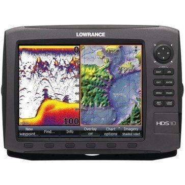
Lowrance HDS 10 Gen2 Fishfinder Plotter
Find it In: Fishing and Marine Electronics, Fish Finder-Plotter Combos.
Status: Discontinued
Lowrance HDS 10 Gen2 Fishfinder Plotter now has HDS Highest-Definition >Broadband Fishfinding built-in that provides: Less Noise, More Targets, Crystal-Clear Clarity, Greater Shallow-Water Detail and Coverage and Incredible Deep-Water Performance.
Lowrance HDS10 Gen2 Fishfinder Plotter has a bottom lock and >scroll back history feature that together with its superb >Broadband enhancements, Lowrance V4.0 Software Upgrade just made it even better & revolutionary Structure Map charting ability (LSS-2 option required), make it a must have in 2013. See why Structure Scan makes a difference in all type of fishing.
- 10.4" 16 Bit Solar Max TFT SVGA 160mm x 210mm, 600V x 800W Pixels daylight viewable LCD display. Screen Size Comparison
- Software update provides AutoRouting which allows users to automatically create the shortest safe route based on selected start and end points using calculations generated from vessel settings (draught, Beam Width and height) and available Chart data, with Navionics Platinum, Nav+ and Navionics Updates Chart.
- Built-in >Broadband transceiver. Adjustable bottom lock.
- Completely sealed and waterproof (IPX7). Built-in flush mount kit.
- Internal lithium battery keeps data for up to 10 years.
- Alarms - shallow, deep, Fish & zone.
- Output power: Equivalent to 30,000w(pp) 3750w(rms). Useable depth: 200/50KHz 500m+ with 1kw Transducer.
- Depth, temperature and Speed. Wide variety of T/H, T/M Biducer and Triducer T/ducer options.
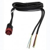
- Display unit supplied with Mounting Bracket and Power Cable. Choice of maps & Transducer options (not included - see options)
- GPS/MAP Combo Features:
- 5000 waypoints.
- C-MAP MAXN, Navionics Silver,Gold & Platinum Map options (What is the difference?)
- 200 Routes & 10 Trails with up to 9,999 points.
- 16 channel Built-in GPS Receiver. (External option).
- NMEA0183/2000 & Ethernet expandability compatible.
- Revolutionary StructureMap Chartplotting ability (requires LSS-2 option)
- Supplied with ESA290 Display, Mounting Bracket, Power Cable, Plug Caps and Sun Cover. Select other features from options.
| Replacement Product (SKU) | Lowrance-HDS12-Gen2-Touch-Combo |
|---|---|
| Brand | Lowrance |
| Country of Manufacture | Unknown |
| Show Ship Free Label | Yes |
| Physical Dimensions | 312mm x 225mm x 92mm (inc.bracket) |
| Screen Size | 10.4" |
| Display Resolution | 800W x 600V pixel |
| Screen Brightness | Unknown |
| IPX Water Rating | IPX7 |
| Voltage | 12vDC |
| Transmit Power | 3750ww RMS |
| Video Input Ports | None |
| Video Output Ports | None |
| Mounting Options | Bracket Mount |
| WiFi Connectivity | None |
| Warranty | 2 Years,Transducer & Fuel Sensor: 1 year |
| Accepted Map Cards | Navionics Micro SD Silver, Navionics Micro SD Gold |
| Waypoints | 5000 |
| Routes | 200 |
| Track Log | 10000 |
| Sonar Compatible | Yes |
| Supports AIS (tracks target ships position) | Yes |
| Tide Tables (from map card option) | Yes |
| Down Imaging (Transducer Dependant) | None |
| Sonar Useable Depth (T/D & Frequency Dependant) | 500m+ with 2kW T/Ducer |
| Side Imaging (Transducer Dependant) | None |
| Output Power: RMS | 3750ww RMS |

